Showing posts with label Gazetteer. Show all posts

Monday, August 18, 2025

Beat, Tattered and Torn

It often happens that certain possessions become “dear” to us. . We become attached to them sometimes because of how long we’ve had them and often, because of sentimental reasoning. I have items that are important to me because of who previously owned them and the fact that these items were important to them also.

    I have statues in my house that are important because my aunt used to own them. Being a “collector” (some might say “packrat") I have a lot of items that used to belong to my parents and because of that, they will remain in the house for years to come. Some items are just cool in my opinion and that is another reason that they will stick around.  “Oh, it is so difficult to get rid of excess when you’re a “collector”!

    I’d like to tell you about an item that has finally come to the end of its time with me. It has been with me for at least twenty years and my heart aches knowing that its time has come.

    It was picked it up at a book sale at the Shaler North Hills Library. I only paid a couple dollars for it but those dollars were well spent! It is a Delorme Pennsylvania Atlas and Gazetteer. Published in 2003, it has been in my car ever since I bought it.

    Back in 1976, Frank Delorme put together an atlas out of highway, town and county maps. He was dissatisfied with the maps of the Maine woods and wanted something better. His first volume was of Maine and he sold it out of his car. By 1986, his company had risen to 75 employees. The company is now owned by Garmin and it sells electronic maps and devices, but it still produces gazetteers of all the states.

    An interesting fact, the headquarters of the company which use to be in Yarmouth, Maine, has the largest rotating world globe in existence. Called Eartha, it is a little over 41 feet in diameter and completes a turn every 18 minutes.

    Having been in my car for such a long time, the atlas is showing its age. Its pages are pulled apart, only the thicker cover remains whole. After trips, time is always spent returning all the pages back to their proper order. It hurts me to see this volume in such a bad condition but I know that it has served me well!

    I don’t remember what car I had when I first got this. The cars came and went but the Gazetteer remained. I have other gazetteers in the house; there is a pile of them from all the different states I’ve visited. If I’ve been there, chances are there is a Gazetteer for that state in the pile. Though I haven’t been to either Alaska or Hawaii, I have copies of these also, just because they’re fun to look at!

    My relationship with maps goes back into childhood. I can remember looking at the maps printed in my books such as Treasure Island and when reading the encyclopedias we had sitting in the living room.  (Remember those?) I would take my father’s gas station maps and spread them out and follow the roads. I was amazed that I could find places that we had traveled to and the roads we had used to get there.

    When I was a Boy Scout, maps became even more important. Imagine being able to find your way through the woods with only a thin dirt path leading you on. My maps helped me stay on the correct paths using only streams, mountains, cliffs and my trusty compass to guide me. Oh, the possibilities were endless. I used to imagine going from one side of the country to the other, using only hiking trails.

    Maps became even more important once I had a drivers license and the ability to travel extreme distances in hardly any time at all.

    Electronic devices, GPSs are great but in my own opinion, I would much rather use a map to get from place to place. There is no doubt that GPSs can be quite useful, I’ve used them at times, BUT, I still prefer a paper map. I use my GPS for geocaching, it is a handheld unit, it isn’t mounted to my car windshield or dashboard. Having researched the caches, I usually don’t use it until I’m in the near vicinity.


    Looking at my beat up Delorme Atlas, paging through its torn pages, I am taken back in time. There are notes written on the margins, routes that had been highlighted, attractions that had been circled, these all take me back to pleasant memories. Coffee stains share the pages with iron furnaces that I’ve photographed and geocaches that have been found. There are parks and overlooks I’ve visited, these maps are like photographs, bringing back memories. The roads inked on the pages have the ability to remind me of the sights I saw while traveling on them, I’m lucky in the fact that I can picture the roadways my finger is tracing. I hate to think about tossing this book and all its memories, but a new one has been ordered.  There are lots of good atlases available, but the Delorme Gazetteer is one of my favorites.

    These atlases not only show me the past, they also show me the future, the possibilities, the places that we haven’t seen yet, but will someday soon. They offer you immense areas where you can lose yourself. (Even though the basic purpose of a map is to avoid getting lost) Some of the best trips have been to go out and just make turns at random. Our state is filled with neat things to see and hopefully I will continue my explorations for a long while to come. I'm happy to say, my new atlas has just been delivered, and you can be sure I’ll have it along to help me find my way!

     Happy Travels!


Thursday, March 21, 2024

The Lure of the Atlas

 When contemplating a trip, I always go to “my maps”. They come in many shapes, sizes and styles. During a recent attempt to bring a bit more organization to my bookshelves, I came across the shelves dealing with maps; books about maps, books which incorporate them in their story lines and books with maps on their pages and on their covers. There were also a group of atlases.

    Atlas, Greek Mythology says that he was a Titan who was punished by the gods for fighting against them. His punishment was to stand on the western edge of the world and hold the weight of the heavens on his shoulders. Along with being a strong man he was also wise and is considered in some texts as the “founder” of astronomy.

    His name became synonymous as a collection of maps or charts after the publication of a book of maps in 1595, made by Geradus Mercator. Published after his death, the volume had a picture of Atlas on it and before long the name atlas became a term to identify a bound collection of maps, books which help us navigate and understand our world. Mercator was important in the map game also, but that story will have to wait until another day.

    Looking around my shelves, I realized that I have quite a collection of atlases. I have some made for children, there are some older ones, (though not really worth much except to me) a few historic reproductions, there are atlases of the stars and even a couple that are atlases of the human body. How is it possible for a person who loves maps, not to have at least one (or two) atlases?

    In my car is an old worn Delorme Atlas and Gazetteer of Pennsylvania. It is over 15 years old, notes are scribbled on its edges and places we’ve visited are circled. A few routes are highlighted. The pages are falling out of it yet I still keep it close at hand.

    I love my Gazetteers, I have a variety of them for the surrounding states. Along with the one in the car, I have two other Pennsylvania Gazetteers, one for the upstairs and one for the downstairs. They are in much better shape than the one in the car and, yes, I use them both frequently! The gazetteer I have of Alaska isn’t used that much but every once in a while…I get it out to just page through it and daydream.

    There are a couple other atlases in my car, one of Pittsburgh and one of the United States. Being a map fiend, dare I say “mapaholic”, there is also a collection of folded paper maps in the pocket behind the passenger seat.

    GPS, no, I rarely use one for driving, only for geocaching. The paper maps work just fine! But, in essence, the GPS is an atlas also. It is a collection of maps which help us through our world. I don’t often use a GPS to help me with my driving but I do use another internet service, Google Maps. I often use this to see where the various turns I need to make are. Using the satellite view I can see what my turns will look like, what buildings or businesses are near-by. Using the street view gives me an idea of what I’ll be seeing before I need to make the turn. I can pick out landmarks to help me prepare for what’s ahead. This isn’t full proof, as this Thursday’s trip proved. (inside joke!)

    Going out to observe the night’s sky, I will pull out some of my star atlases.  Using these helps me to plan the night’s activities, giving me an idea of what’s visible in the sky that night. Whenever a comet is visible in our skies, or if one has just been discovered I will drag out the sky charts to see where it is. To name a couple of the volumes I have, there is the children’s book The Stars, by H.A. Ray, an atlas made with simple sketches. There is also Norton’s Star Atlas and Reference Handbook that I have been using since I first got involved with astronomy. A Bright Star Atlas by Terion and Skiff helps out when I need some quick and easy charts and the Uranametria for when I need a bit more detail.


    Once again, in our modern times, this can be done on your computer or cell phone but I still like seeing it on paper. Pointing your phone at the sky doesn’t help you become familiar with the constellations and stars, to me, it’s just a nice shortcut. I often add notes and dates for various things I’ve seen, marring my books but adding a bit of history to them.

    I have some older atlases including a 1927 Literary Digest, Atlas of the World and Gazetteer. It is filled with hard to read maps with city names squeezed into the states and countries. Using this to get from here to there would be next to impossible!  A Maury’s New Elements Geography (Pennsylvania Edition) from 1913 is fun to read. Published as a geography book it can still be used as an atlas. Along with the maps of the world and the U.S. states, it is filled with information about the various countries and states. Granted, the facts are a bit out of date but that is one of the things which make it fun to browse through. 

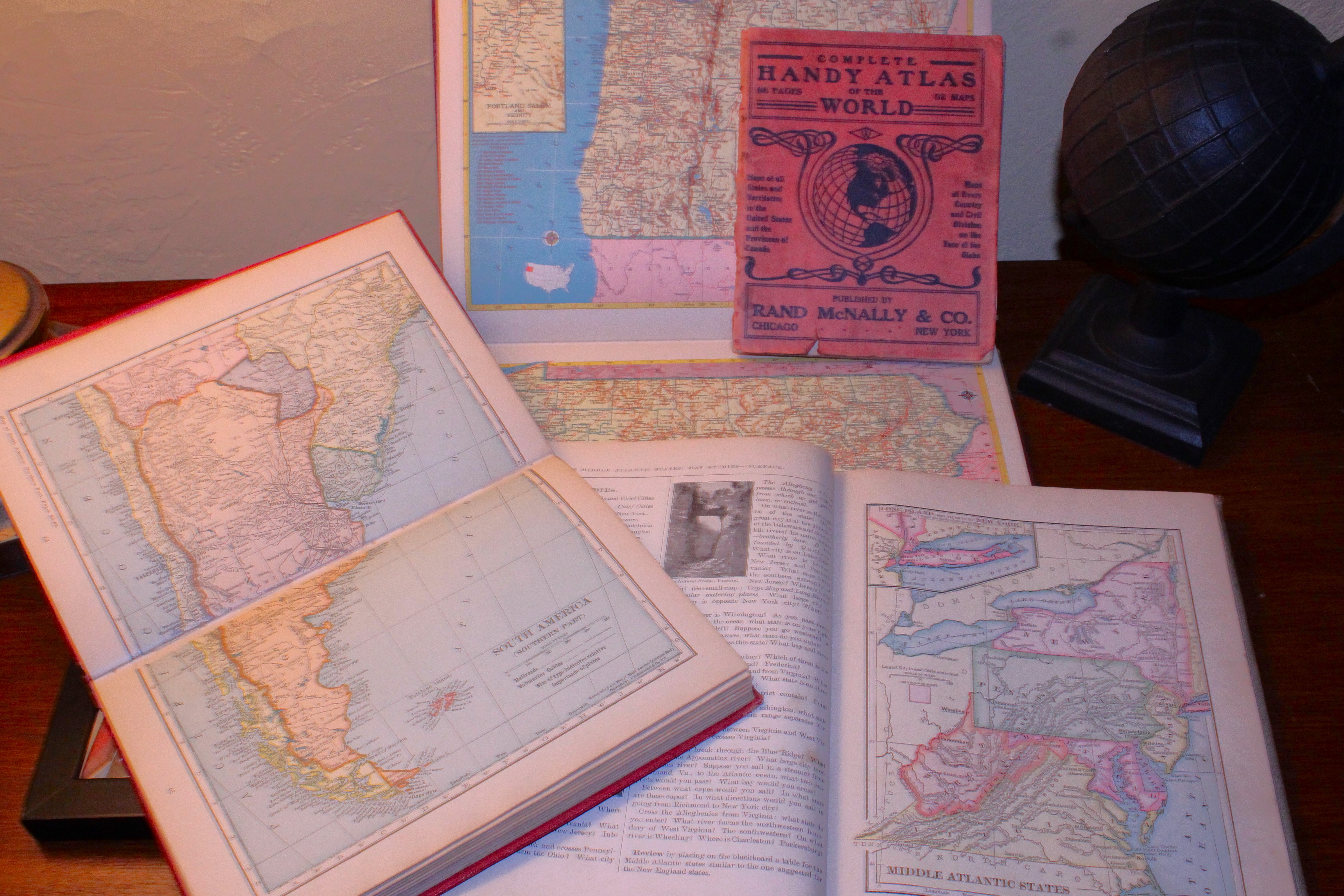
    My worn copy of a 1917 Complete Handy Atlas of the World is a small paperbound book that I found under a pile of magazines at a yard sale. It feels as if it has been used thousands of times throughout its life. Small and compact but still used a lot!

    In the back room I have a huge atlas; it is too big to fit on any of my shelves. Measuring 12” x 18” The Times Atlas of the World, Comprehensive Edition is also outdated. Printed in 1967, it is now a bit more than just a collection of maps and charts, it is also a collection of history! The populations of the countries have changed, as have the world’s inhabitants. The crops grown and the products manufactured are often different and many of the names of countries have changed. Due to the heftiness of this book you have to be a bit of an Atlas yourself to enjoy it!

    Well, enough about these, it’s time to get back to the dusting and organizing of my shelves, who knows what other atlases I might find in the process… today or in the future!


Sunday, April 11, 2021

Borders, Bridges, Birds and Beers

 4.10.2021

The Washington County side of the marker

                On my way into work I pass a couple stone markers. Sitting beside the road, showing obvious signs of age, they mark the line between Allegheny and Washington Counties. They got me thinking about whether there were any others around.

                On following days, I was extra careful in watching for any others. I checked some maps and drove down a couple roads which crossed the county line. Other than the occasional “modern day” signs made out of metal, I saw or found nothing.

                While pursuing my Gazetteer I saw a spot where Allegheny, Beaver and Washington Counties all connect. It looked like a future road trip to me. The future came on Saturday.

                We headed west towards “the spot”.  Soon we started seeing detour signs warning that the road was closed ahead.  We figured we would go as far as we could and deal with the detour when we got to it. It couldn’t have turned out better. The road was closed just past the road we were going to take!

                A mile or two past the road blockage we came to the small community of Murdocksville. The maps show the county lines coming together at a road intersection just before a bridge crossing Raccoon creek.  We pulled over and got out to look around.

                The bridge was new, as far as Pennsylvania bridges go. We could see where the dirt surrounding it had been moved and reshaped. Looking in the woods we saw no marker or anything possibly concerning the county lines. Crossing the bridge we found a historical marker which told about a grist mill that once stood near-by.

                The White Grist Mill once sat beside Raccoon creek, using the water to power the mill. Later it was converted to steam. From where we stood by the bridge, all remnants of the mill and the dam that once stood here were gone. We didn’t want to go onto the property beside the stream since it was someone’s yard. The community was called White Mill and eventually was renamed Murdocksville after one of the residents.

A possible monument base?

                Across the street from the sign was a stone pedestal covered by a bush. I wish I had looked at it closer, it might have been where a marker once stood. The wall it was connected to bordered another yard and it wasn’t until I had looked at the photos that I realized what it might have been. Next trip I guess… For now, as far as I’m concerned, that’s where the counties meet.

                Looking at our Gazetteer, (everyone should have one in their car!) we saw that we were fairly close to a covered bridge. This small icon on the map is what took us on our next leg of the journey. Even though we had a detailed map of the area, we still managed to miss it. I always say, “What’s a good trip without getting lost once or twice?”

                We ended up at a small brewery/greenhouse. We stopped and asked a woman standing outside of it where the covered bridge was. She gave us good directions and then said to stop back and have a beer after we found it. We decided that now was as good as later. The Coal Tipple Brewery had a couple picnic tables sitting under a porch roof, some potted plants in the yard for sale and a small fire burning in a burn ring. It looked ideal for a short break.

                Putting on our masks we went inside and bought a couple glasses of fresh, dark stout. We went out to the porch and sat down near the fire ring. Light smoke made the air smell good and the warm temperatures made it perfect for sitting outside and enjoy a freshly brewed beer.

                With our thirsts satiated, we returned to our quest for the elusive covered bridge. Nearly there we passed a dirt road that had a Bridge Closed sign at its end. We turned down it to see what was there. The road went down a hillside into the valley. Steep drop offs were on my side, the stream and woods spread out below. On the ride down, a brown tailed hawk flew over the car and into the woods, close enough to allow us to see the beautiful patterns on its wings and back. It was gone just as quickly as it appeared.  We also saw a Piliated Woodpecker as we neared the bottom of the hillside. It perched on a tree long enough for us both to see it and to appreciate how huge it was. This is the largest type of woodpecker, some being close to 20” long! Its bright red crest is what caught our eye first, then its size. It flew off towards the stream before I could stop the car.

Raccoon Creek Rd. Bridge

                The road ended at the bridge. Large piles of dirt blocked access to it by car. It was an old metal bridge with a wooden floor. I would have no qualms about crossing it if the dirt wasn’t there. There were a couple kinks in the beams, whether from accidents or metal stress I don’t know. Rust was working on the beams also so perhaps it was best that the dirt piles kept the car off it!

                It was nice and quiet in the valley, the only sounds being the water flowing by and some birds chirping. The sounds were soft and quiet, hardly noticeable at all. Skunk cabbage could be seen pushing its sprouts up through the moist dirt all around us. Spring was well upon us!

Lyle Covered Bridge

                After some photos we returned to the “main” road and our quest for the covered bridge. A half mile further and we came to the bridge. Painted red it sat in a picturesque setting. After a couple pictures we returned to the car and following the road we were on, headed in the general direction of home. We weren’t sure exactly where we were but we figured we’d come to a road we knew or recognized soon enough. That is exactly what happened and another hour later we were back home again.

                We hadn’t found any stone markers but we really didn’t complain. Our journey took us through three counties, showed us some history, a refreshing taste of fresh beer, some beautiful birds and a couple bridges. Not bad for a four hour trip on a nice day!


The Pittsburgh Book Crawl 2026

  The past week was miserable. Not only were the temperatures in the high 80’s and above, on Thursday we were attacked with the smoke from t...